 Wanapum Viewpoint And Columbia River Scenic Overlook
3 images 1 contributors Shoot with care
Steve West
Shoot with care
There are dangerous cliffs in the area, use good judgement. During the summer months be aware of rattlesnakes in the area.
About this spot
Millions of years ago, this region was humid and the topography was a network of streams and hills. There was no Cascade Range and moisture-laden clouds sweeping inland from the Pacific created an environment where a diversified forest thrived.
Over time, floods of molten basaltic lava welled up through fissures in the earth’s crust, eventually engulfing the area in lava several thousand feet thick. Between eruptions lakes and marshes formed and forests grew. With each lava flow, the forests were destroyed and some logs were petrified.
With the outpouring of lava, the raising of the Cascade Range began. This uplift cut off the moist winds from the west, leaving Eastern Washington an arid region. Erosion by the elements, rivers, and floods cut through one lava flow after another, exposing the petrified wood as it is seen today.
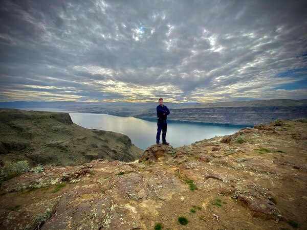
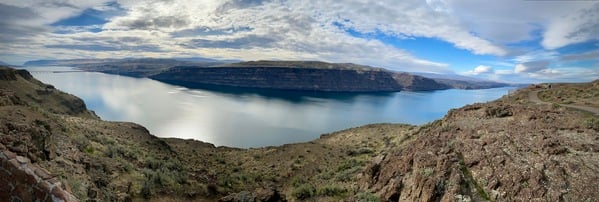
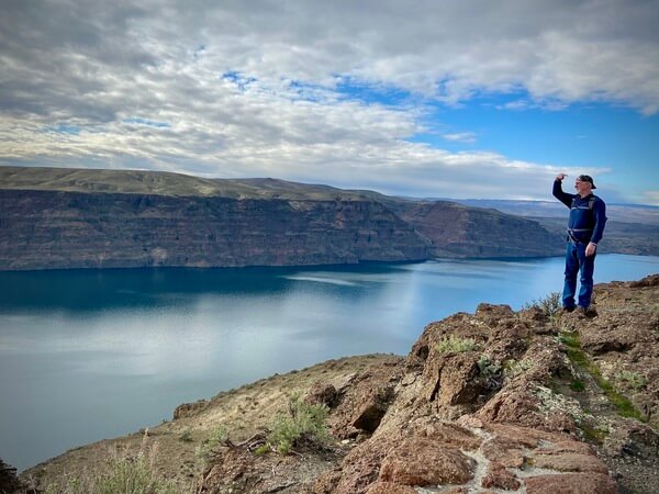
This is a nice little spot to pause and rest from a long drive on Interstate 90 (WEST bound only!) and take in the panoramic view of the Mighty Columbia River.
Over time, floods of molten basaltic lava welled up through fissures in the earth’s crust, eventually engulfing the area in lava several thousand feet thick. Between eruptions lakes and marshes formed and forests grew. With each lava flow, the forests were destroyed and some logs were petrified.
With the outpouring of lava, the raising of the Cascade Range began. This uplift cut off the moist winds from the west, leaving Eastern Washington an arid region. Erosion by the elements, rivers, and floods cut through one lava flow after another, exposing the petrified wood as it is seen today.
This is a nice little spot to pause and rest from a long drive on Interstate 90 (WEST bound only!) and take in the panoramic view of the Mighty Columbia River.
Join PhotoHound to learn how, where and when to capture amazing photos here
- Know the best times, seasons & shooting conditions
- Detailed directions - maps, co-ordinates and directions
- Know how to get there - where to park or how to reach there using public transport
- Browse inspirational photos and learn how they were taken - see the EXIF details
- Bookmark your favourite spots for future reference
- Know exactly when to shoot for beautiful photographs - sunrise, sunset, blue hour and astrophotography
- Detailed, 7-day weather forecast at this location
- Share your images with like-minded travel photographers
Essential Information
Web links
https://washingtonourhome.com/columbia-gorge-overlook-and-the-wanapum-indian-tribe/


