Emerald Ridge, Mount Rainier National Park
5 images 1 contributors
T. Kirkendall and V. Spring

About this spot
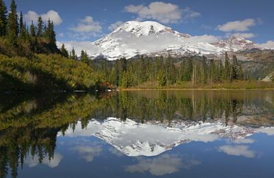
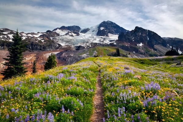
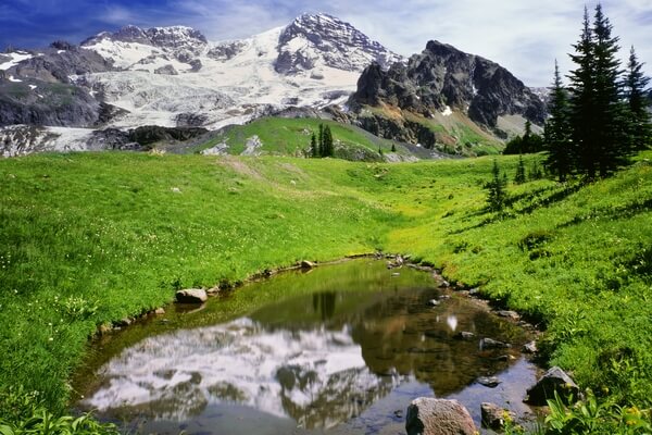
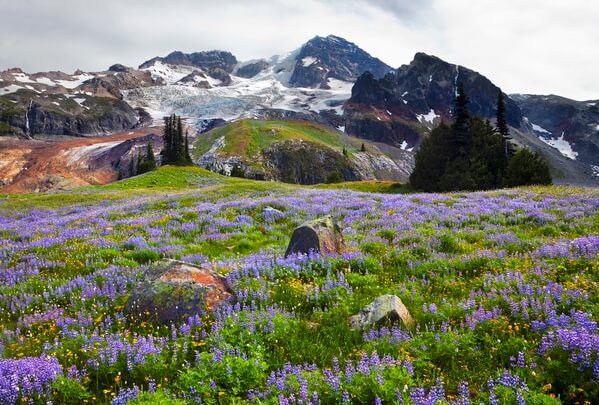
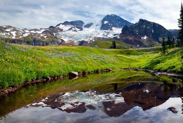
Emerald Ridge culminates with an open meadow and a magnificent view of Mt. Rainier. The ridge is located between the South Puyallup River and Tahoma Creek which originate at the base of the Tahoma and South Tahoma Glaciers. Once the snow has melted off the meadow on the crest of Emerald Ridge, wildflowers take over. As an extra bonus, a small tarn holds water for much of the summer and is perfectly situated for reflecting The Mountain in its still waters. This is not an easy location to access, requiring a 16 mile round trip hike to from the Westside Road to the crest of the ridge. Many hikers prefer to make a multi-day trip of it by looping around to Klapatche Park and St. Andrews Park.
Join PhotoHound to learn how, where and when to capture amazing photos here
- Know the best times, seasons & shooting conditions
- Detailed directions - maps, co-ordinates and directions
- Know how to get there - where to park or how to reach there using public transport
- Browse inspirational photos and learn how they were taken - see the EXIF details
- Bookmark your favourite spots for future reference
- Know exactly when to shoot for beautiful photographs - sunrise, sunset, blue hour and astrophotography
- Detailed, 7-day weather forecast at this location
- Share your images with like-minded travel photographers
Essential Information
Guides
This spot appears in 1 guide.