Deception Pass Bowman Bay
1 images 1 contributors
Joe Becker

About this spot
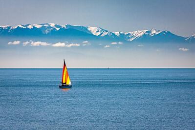
Deception Pass State Park encompasses over 4,000 acres and has more than 75,000 feet of saltwater shoreline and another nearly 34,000 feet of freshwater shoreline on three lakes. The park is centered around the picturesque, quarter-mile long Deception Pass Bridge that stands about 180 feet above the rip-tide filled waters. The park is full of scenic beaches, rocky coves, lakes, and forests. Bowman Bay has a half-mile long sandy crescent beach encompassed by rocky shores. South of the bay, Lighthouse Point is rocky headland at the mouth of Deception Pass with several grass-covered rock outcroppings above the water which provide wide vistas. Along the trail to Lighthouse Point, there is a short spur loop trail to Lottie Point where there are additional, though more limited, views.
Join PhotoHound to learn how, where and when to capture amazing photos here
- Know the best times, seasons & shooting conditions
- Detailed directions - maps, co-ordinates and directions
- Know how to get there - where to park or how to reach there using public transport
- Browse inspirational photos and learn how they were taken - see the EXIF details
- Bookmark your favourite spots for future reference
- Know exactly when to shoot for beautiful photographs - sunrise, sunset, blue hour and astrophotography
- Detailed, 7-day weather forecast at this location
- Share your images with like-minded travel photographers
Guides
This spot appears in 1 guide.