 Lake Lenore Grand Coulee Basalt
1 images 1 contributors Shoot freely
Steve West
About this spot
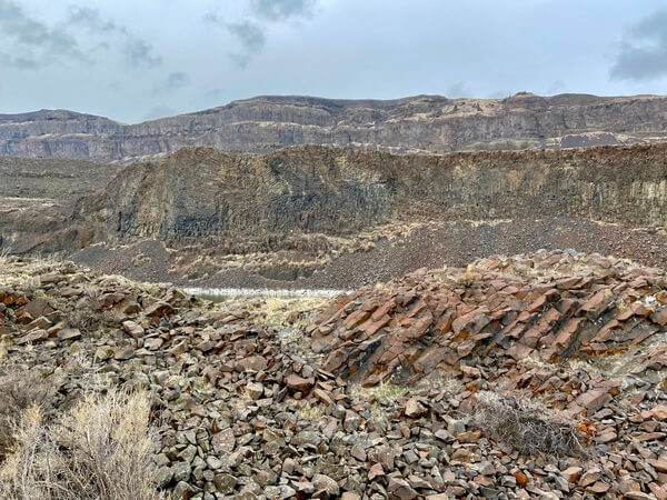
The volcanic remains within the coulee were quite eye-catching. The lake itself and the surrounding area is all part of the Grand Coulee, (not to be confused with the name of the dam).
Lake Lenore (a.k.a. Lenore Lake) is located in Grant County, Washington. It is a 1,670-acre (680 ha) lake formed by the Missoula Floods in the lower Coulee just north of the town of Soap Lake, Washington. It is situated between Alkali Lake to the north and Soap Lake to the south. The lake is rather narrow but long. The length of the lake runs north-south alongside Washington State Route 17 leading from near the city of Soap Lake to Coulee City, Washington.
Lenore Canyon is a coulee associated with the development of the Scablands.
Join PhotoHound to learn how, where and when to capture amazing photos here
- Know the best times, seasons & shooting conditions
- Detailed directions - maps, co-ordinates and directions
- Know how to get there - where to park or how to reach there using public transport
- Browse inspirational photos and learn how they were taken - see the EXIF details
- Bookmark your favourite spots for future reference
- Know exactly when to shoot for beautiful photographs - sunrise, sunset, blue hour and astrophotography
- Detailed, 7-day weather forecast at this location
- Share your images with like-minded travel photographers


